
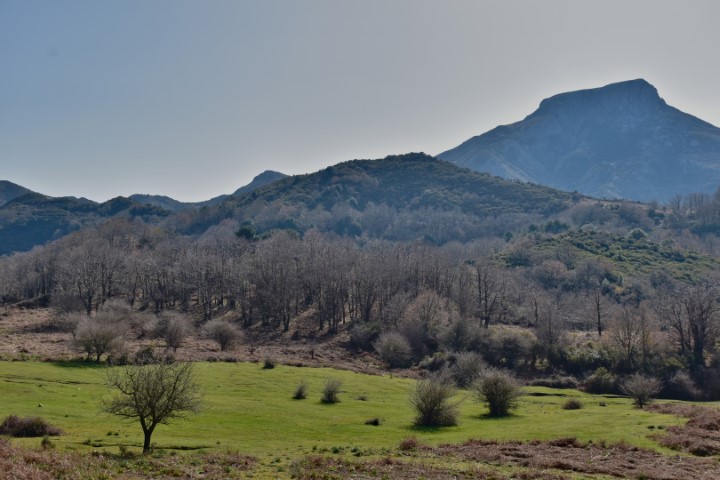
The Reserve > Trails
The trails shown on the interactive map, recommended by the Managing Authority, represent nature trails of special interest that wind through unique, pristine environments, distinguished by level of difficulty.
The trails shown on the interactive map, recommended by the Managing Authority, represent nature trails of special interest that wind through unique, pristine environments, distinguished by level of difficulty.
Length: 8.33Km; Ascent: 637m; Difficulty: Tourist
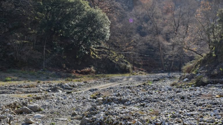
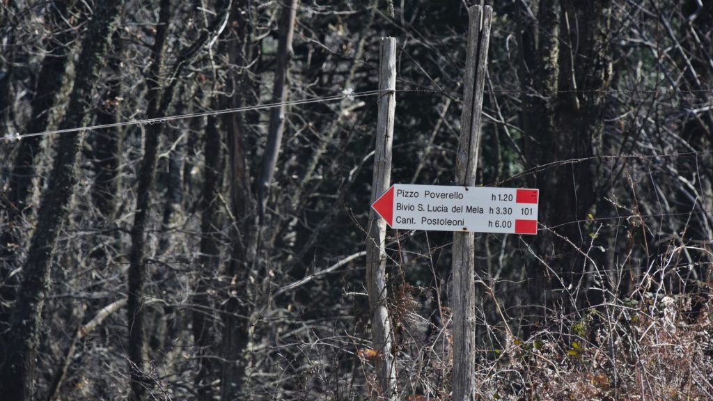
Along this main road that runs east of the Reserve boundary, it is possible to reach most of the designated trails, viewpoints and rest areas.
Length: 5.77Km; Ascent: 564m; Difficulty: Hiking
Starting from the nearby town of Fiumedinisi, it is possible to reach “Rifugio Nociara”: an equipped area near “San Ferdinando” forest characterized by the presence of oaks, chestnut trees and majestic specimens of holly.
Length: 0.56Km; Ascent: 81m; Difficulty: Experienced Hikers, with Equipment
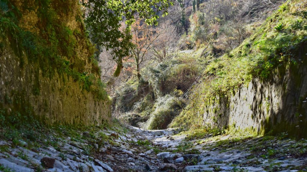
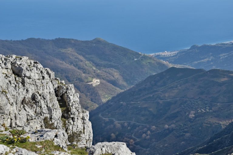
Spectacular trail along the Valley of the Hermits, a canyon topped by a vegetated gallery of linden trees, holm oaks, strawberry trees and Mediterranean scrub that creeps for about 2 km along the Fiumara Santissima.
Route suitable for experienced hikers equipped with appropriate gear and equipment
(protective helmet EN 12492).
Length: 5.47Km; Ascent: 292m Difficulty: Hiking
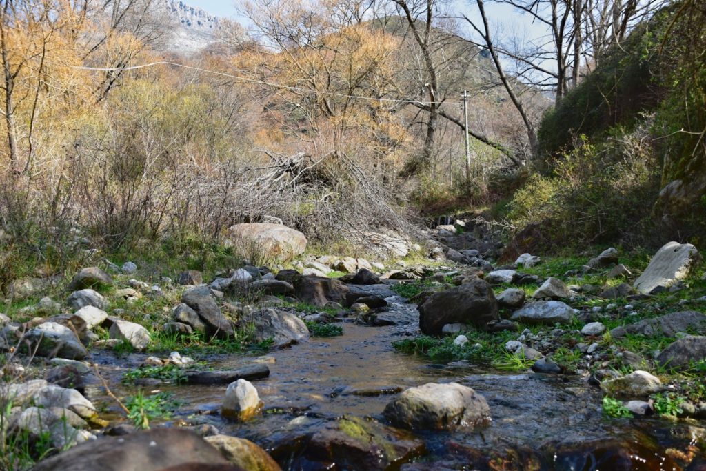
A path that runs along the stream in the “Valle Làmeri,” encountering the works of the “Santissima” aqueduct. At an altitude of 850 meters, crossed the Peloritani ridge it will be possible to reach “Piano Margi.”
Length: 17Km; Ascent: 1128m; Difficulty: Experienced Hikers
A path from “Pizzo Cipolla” to “Acqua Lima” crosses the reserve for about 15 km, allowing visitors to admire the typical habitats of the reserve and the beautiful expanses of tree heather, an evergreen shrub with large, fragrant white inflorescences.
Length: 6.32Km; Ascent: 660; Difficulty: Experienced Hikers
A road suitable for mountain vehicles, going from asphalt, to rammed earth, to some rougher spots. It is possible to park the vehicle near the “Puzzo” shelter and continue on foot.

Length: 2.43Km; Ascent: 375m; Difficulty: Experienced Hikers
A route starting from “Poggio Tiani” (Municipality of Alì Superiore), towards the equipped area of “Puntale Puzzo.” From here it is possible to climb to the top of Mt. Scuderi from the southern slope.
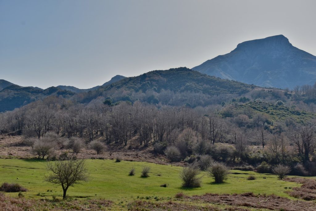
Length: 15.2Km; Ascent: 1357; Difficulty: Experienced Hikers
A municipal road accessible to off-road vehicles, switching from asphalt to dirt.
Length: 2.72Km; Ascent: 346; Difficulty: Experienced Hikers
Drive along the Itala municipal road for about 15 km to Portella Salice, the entrance to the Reserve. A 2.7-kilometer trail leads to the summit of Mt. Scuderi.
Descrizione – Lungo questa strada principale che si snoda ad Est del confine della Riserva è possibile raggiungere gran parte dei sentieri indicati, punti panoramici e aree di sosta.
Itinerario – Partendo da Fiumedinisi, percorrere “Via Fiume” lungo il “Torrente Fiumedinisi”; superato il ponte svoltare a sinistra verso “C.da Santissima” in direzione “Pedaria”, quindi proseguire da qui per circa 8 Km sino a giungere il parcheggio della “Santissima”.
Premessa Obbligatoria – Un tratto del percorso ricade, per rischio di crolli, in aree a pericolosità: P4 – molto elevata.
Da ciò deriva la necessità di adottare le opportune misure di allertamento (D.P. n. 09/AdB del 06/05/2021)
Descrizione – Partendo dal vicino paese di Fiumedinisi, è possibile raggiungere “Rifugio Nociara”: un’area attrezzata vicino bosco “San Ferdinando” caratterizzato dalla presenza di querce, castagni ed esemplari maestosi di agrifoglio (Ilex aquifolium). In parallelo a questo sentiero è possibile percorrere, sul lato destro del “Torrente Vacco”, una strada in terra battuta che consente di ammirare la splendida vegetazione presente sulle sponde di foreste di ripisilva a galleria di Salice, Pioppo, Platano orientale, ecc. Inoltre, Il “Torrente Vacco” è un grande laboratorio geologico all’aperto, un’area mineraria dove si trovano le “Pietre di Caloro” (miniere aurifere).
Itinerario – Imboccare la strada in direzione della “Fiumara Santissima”, svoltare la prima traversa sulla sinistra in direzione del “Torrente Capitanello”, quindi proseguire per circa 5,7 Km lungo la strada sterrata che conduce al rifugio “Nociara”.
Premessa Obbligatoria – L’intero percorso ricade, per rischio di crolli, in aree a pericolosità: P4 – molto elevata.
Da ciò deriva la necessità di adottare le opportune misure di allertamento (D.P. n. 09/AdB del 06/05/2021)
Descrizione – Percorso adatto ad escursionisti esperti muniti di adeguato equipaggiamento ed attrezzatura (casco protettivo EN 12492). Spettacolare percorso lungo la Valle degli Eremiti, un canyon sormontato da una galleria vegetale di tigli, lecci, corbezzoli e macchia mediterranea che si insinua per circa 0,5 km lungo la fiumara Santissima. La valle, caratterizzata dalla presenza di grotte un tempo frequentate da eremiti, è un luogo incontaminato, dove la natura è padrona assoluta.
Itinerario – Partendo da Fiumedinisi, percorrere “Torrente Fiumedinisi” verso Nord per circa 8,5 Km, arrivati al “Fiume della Santissima”, proseguire verso nord-ovest, in direzione “Valle degli Eremiti”.
Descrizione – Un percorso che costeggia il torrente nella “Valle Làmeri”, incontrando le opere dell’acquedotto della “Santissima”. A quota 850 metri, incrociata la dorsale dei Peloritani sarà possibile raggiungere “Piano Margi”.
Itinerario – Proseguendo lungo il “Fiume della Santissima”, lungo la strada sterrata che lo costeggia, al bivio per la “Valle degli Eremiti” svoltare a destra, continuare per circa 3,8 Km per giungere a “Piano Margi”.

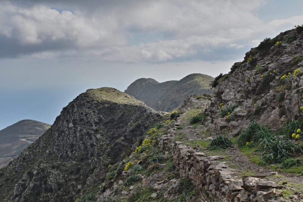
Descrizione – Il “Sentiero Italia”, all’interno della riserva ripercorre la “Dorsale dei Peloritani”, nota come Strada militare dove si susseguono picchi, crinali, fenditure e gole inaccessibili entro le quali scorrono innumerevoli corsi d’acqua che a valle si aprono in ampie fiumare. Sentiero che da “Pizzo Cipolla” ad “Acqua Lima” attraversa la Riserva per circa 17 Km, consente di ammirare gli habitat tipici della riserva e le bellissime distese di erica arborea, arbusto sempreverde dalle grandi infiorescenze bianche e profumate.
Itinerario – Proseguendo lungo il torrente “Santissima” sino a “Piano Margi” si giungerà al “Sentiero Italia”, un sentiero tracciato dal CAI (Club Alpino Italiani) e riconoscibile per i segnali bianco/rosso marcati lungo il territorio. Da “Piano Margi” il sentiero si biforca: proseguendo a destra si arriva ad “Acqua Lima”, in direzione opposta si giunge a “Pizzo Cipolla”.
Descrizione – Una strada adatta a veicoli da montagna, passando dall’asfalto, alla terra battuta, fino ad alcuni punti più impervi. È possibile parcheggiare il veicolo nei pressi del rifugio “Puzzo” e proseguire a piedi.
Itinerario – Partendo da Alì Terme, imboccare la strada provinciale per raggiungere il comune di Alì. Percorrere la circonvallazione per circa 3,5 Km. Arrivati a “Portella Spiria”, svoltare a sinistra per arrivare all’area attrezzata “Puntale Puzzo”. Da questo punto si diparte un sentiero pedonale di circa 1,5 Km che giunge a “Monte Scuderi”.
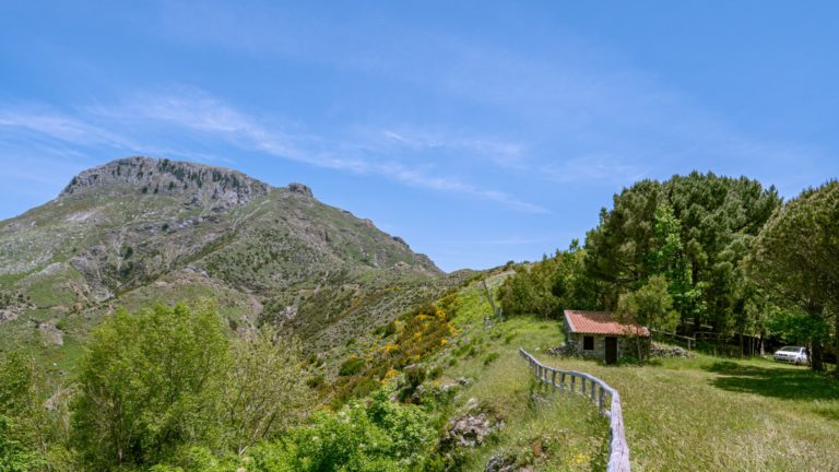
Descrizione – Un percorso partendo da “Poggio Tiani” (Comune di Alì), verso l’area attrezzata di “Puntale Puzzo”. Da qui è possibile salire in cima a Monte Scuderi dal versante Sud. L’area dispone inoltre di un bagno per disabili e previa prenotazione, la possibilità di usufruire di una carrozzina pensata per la montagna. Per informazioni telefonare alla sede di Messina dell’ente gestore.
Itinerario – Percorsa la strada da Alì, si giunge nei pressi di “Poggio Tiani”. Da qui proseguendo lungo la strada: sulla sinistra si arriva a “Puntale Puzzo”, sulla destra si giunge su un sentiero tracciato che prosegue lungo la dorsale sino a “Monte Scuderi”.
Descrizione – Una strada accessibile per veicoli fuoristrada adatti per la montagna, passando dall’asfalto alla terra battuta fino ad alcuni punti più impervi per la presenza di formazioni rocciose.
Itinerario – Partendo dal comune di Itala, proseguire lungo la strada provinciale, svoltare sulla sinistra dopo circa 1 Km all’altezza di “Casalello”. Raggiunto il cimitero di Itala proseguire sulla strada che congiunge con il comune di Alì, quindi svoltare a destra dopo circa 2 Km. Seguire le indicazioni stradali e proseguire sempre dritto sino a raggiungere “Portella Salice” in area di Riserva.
Premessa Obbligatoria – Un tratto del percorso ricade, per rischio di crolli, in aree a pericolosità: P3 – Elevata.
Da ciò deriva la necessità di adottare le opportune misure di allertamento (D.P. n. 09/AdB del 06/05/2021)
Descrizione – Percorrendo la strada comunale Itala per circa 15 Km si giunge a Portella Salice, ingresso della Riserva. Un sentiero di 2,3 Km permette di raggiungere la vetta di Monte Scuderi. Lungo il percorso sono ben visibili antiche neviere in pietra di forma circolare, inoltre, è possibile ammirare rari endemismi della vegetazione rupicola.
Itinerario – Partendo da Alì, raggiunta la fine della strada principale nei pressi di “Portella Salice”, inizia il sentiero. Da qui proseguendo a piedi (parcheggio vicino “Portella Salice”) per circa 2,7Km, si raggiungere la cima di Monte Scuderi. Il sentiero corre lungo sinistra sino al versante Nord del monte.
La Riserva di Fiumedinisi e Monte Scuderi è, prima di tutto, una Riserva Naturale protetta, curata ed a tua disposizione tutto l’anno: vivila e rispettala.
Esplora anche:
Fiumedinisi and Monte Scuderi Reserve is, first and foremost, a protected Nature Reserve, cared for and available to you all year round: experience and respect it.
Also explore:
Description – Along this main road that runs east of the Reserve boundary, it is possible to reach most of the designated trails, viewpoints and rest areas.
Itinerary – Starting from Fiumedinisi, go along “Via Fiume” along the “Fiumedinisi Torrent”; after the bridge turn left towards “C.da Santissima” in the direction of “Pedaria,” then continue from here for about 8 km until you reach the “Santissima” parking lot.
Mandatory Preamble.
– A section of the route falls, due to risk of collapse, in hazard areas: P4 – very high.
Hence the need to take appropriate warning measures (P.D. No. 09/AdB of 06/05/2021)
Description – Starting from the nearby town of Fiumedinisi, it is possible to reach “Rifugio Nociara”: an equipped area near “San Ferdinando” forest characterized by the presence of oaks, chestnut trees and majestic specimens of holly(Ilex aquifolium). Parallel to this path, it is possible to walk on the right side of the “Vacco Stream” a dirt road that allows you to admire the beautiful vegetation on the banks of ripisilva gallery forests of Willow, Poplar, Eastern Platanus, etc. In addition, The “Vacco Stream” is a large outdoor geological laboratory, a mining area where the “Caloro Stones” (gold mines) are located.
Itinerary – Take the road in the direction of “Fiumara Santissima,” turn the first crossroad on the left in the direction of “Torrente Capitanello,” then continue for about 5.7 km along the dirt road that leads to the “Nociara” refuge.
Mandatory Foreword.
– The entire route falls, by risk of collapse, in hazard areas: P4 – very high.
Hence the need to take appropriate warning measures (P.D. No. 09/AdB of 06/05/2021)
Description – Route suitable for experienced hikers with appropriate equipment and gear (protective helmet EN 12492). Spectacular route along the Valle degli Eremiti, a canyon topped by a vegetated gallery of linden trees, holm oaks, strawberry trees and Mediterranean scrub that creeps for about 0.5 km along the Fiumara Santissima. The valley, characterized by the presence of caves once frequented by hermits, is an unspoiled place where nature is absolute mistress.
Itinerary – Starting from Fiumedinisi, travel along “Torrente Fiumedinisi” northward for about 8.5 km, arrived at the “Fiume della Santissima,” continue northwestward in the direction of “Valle degli Eremiti.”
Description – A trail that runs along the stream in the “Làmeri Valley,” encountering the works of the “Santissima” aqueduct. At an altitude of 850 meters, crossed the Peloritani ridge it will be possible to reach “Piano Margi.”
Itinerary – Continuing along the “Fiume della Santissima,” along the dirt road that runs alongside it, at the junction for “Valle degli Eremiti” turn right, continue for about 3.8 km to reach “Piano Margi.”
Description – The “Sentiero Italia,” within the reserve retraces the “Peloritani Ridge,” known as the Military Road where inaccessible peaks, ridges, crevices and gorges follow one another within which innumerable streams flow, opening downstream into wide torrents. Path that from “Pizzo Cipolla” to “Acqua Lima” crosses the Reserve for about 17 km, allowing you to admire the typical habitats of the reserve and the beautiful expanses of arboreal heather, an evergreen shrub with large white, fragrant inflorescences.
Itinerary – Continuing along the “Santissima” stream to “Piano Margi” you will reach the “Sentiero Italia,” a trail marked out by the CAI (Italian Alpine Club) and recognizable by the white/red signs marked along it. From “Piano Margi” the trail forks: continuing to the right to “Acqua Lima,” in the opposite direction to “Pizzo Cipolla.”
Description –A road suitable for mountain vehicles, going from asphalt, to rammed earth, to some rougher spots. You can park your vehicle near the “Puzzo” hut and continue on foot.
Itinerary – Starting from Alì Marina, take the provincial road to reach the town of Alì Superiore. Drive along the ring road for about 3.5 km. When you reach “Portella Spiria,” turn left to arrive at the “Puntale Puzzo” picnic area. A footpath of about 1.5 km branches off from this point to “Monte Scuderi.”
Description – A route starting from “Poggio Tiani” (Municipality of Alì Superiore), towards the equipped area of “Puntale Puzzo”. From here it is possible to climb to the top of Mt. Scuderi from the southern slope.
Itinerary-Traveled down the road from Alì Superiore, we come to the vicinity of “Poggio Tiani.” From here continue along the road: on the left you come to “Puntale Puzzo,” on the right you come to a marked path that continues along the ridge to “Monte Scuderi.”
Description – An accessible road for off-road vehicles suitable for the mountains, going from asphalt to packed earth to some more inaccessible points due to the presence of rock formations.
Itinerary – Starting from the town of Itala, continue along the provincial road, turn left after about 1 km at the height of “Casalello.” When you reach the Itala cemetery, continue on the road that connects with the town of Alì, then turn right after about 2 km. Follow the road signs and continue straight ahead until you reach “Portella Salice” in Reserve area.
Mandatory Preamble.
– A section of the route falls, due to risk of collapse, in hazard areas: P3 – High.
Hence the need to take appropriate warning measures (P.D. No. 09/AdB of 06/05/2021)
Description- Drive along the Itala municipal road for about 15 km to Portella Salice, the entrance to the Reserve. A 2.3-kilometer path leads to the summit of Mt. Scuderi. Ancient circular stone snowpits are clearly visible along the route, and rare endemics of rock vegetation can also be seen.
Itinerary –